Workflows for Inspection and Management of Transportation Infrastructure
At a high level, RUBIX is a simple infrastructure inspection and management solution that allows users to efficiently gather and host performance and deterioration information related to various types of infrastructure. Further, the solution aids decision processes related to managing these transportation assets. The solution is comprised of automated field collections apps, web-based visualization tools, and customizable data analysis and reporting/export tools.
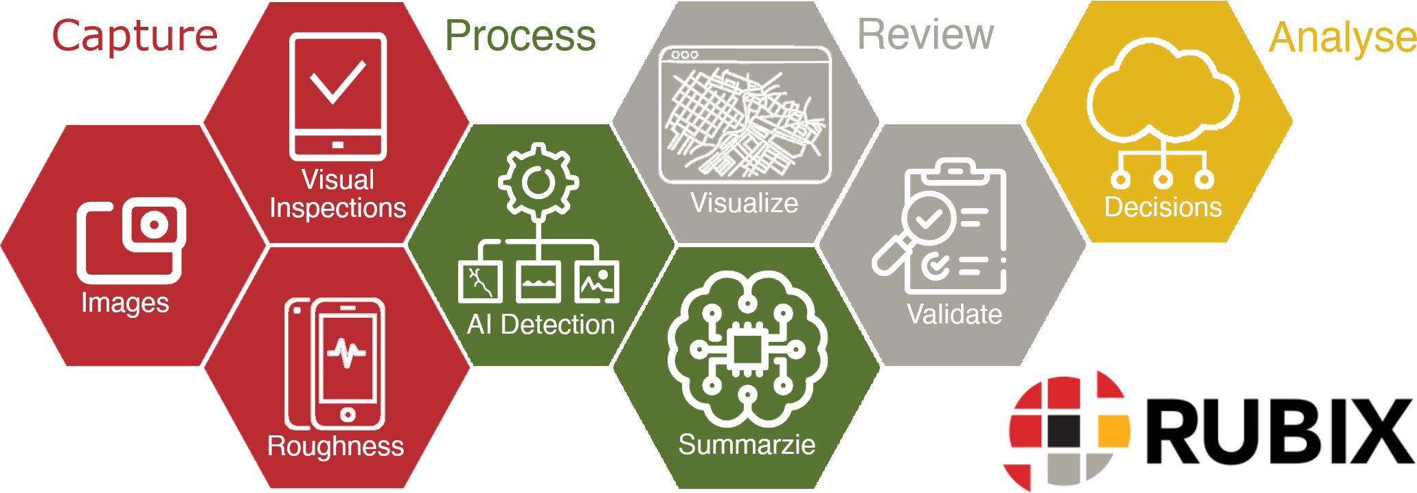
- Field Inspection Tools to support AI processing
Industry Standard Automated Processing and Condition Analysis
Robust Web-Based Mapping Visualizations
Mobile Image Viewing, including support for Planar and Panoramic Imaging
Image Feature Annotation and Inventory Tools to aid Machine Learning
Infrastructure Life Cycle Analysis Module
Field Data Capture Tools
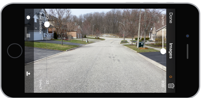
rCapture is the module within the RUBIX application suite that allows users to collect, host, view, and extract information from mobile images. This includes the ability to leverage images from 3rd party image collection devices such as action cameras, high quality mobile imaging systems, and others. rCapture is configured and deployed according to the data collection platform being used i.e. Vehicle, Bike, or other.
Mobile Image Capture from your Smartphone or Action Camera
Seamless import and viewing capabilities to RUBIX
Distance based Image Capture
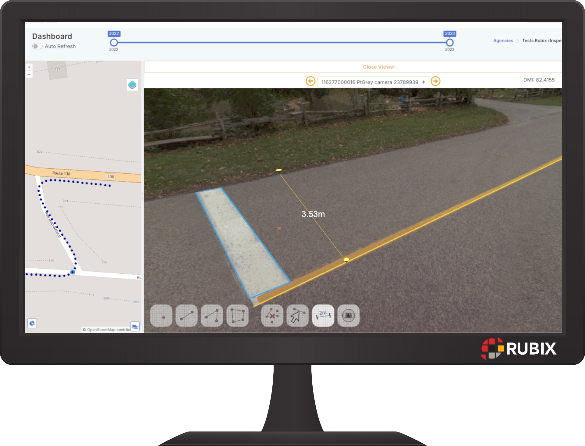
- Photogrammetry support for measurements from image
Automatic Image Quality Adjustments
Automated GIS Referencing to Basemap
- Panoramic Image Support
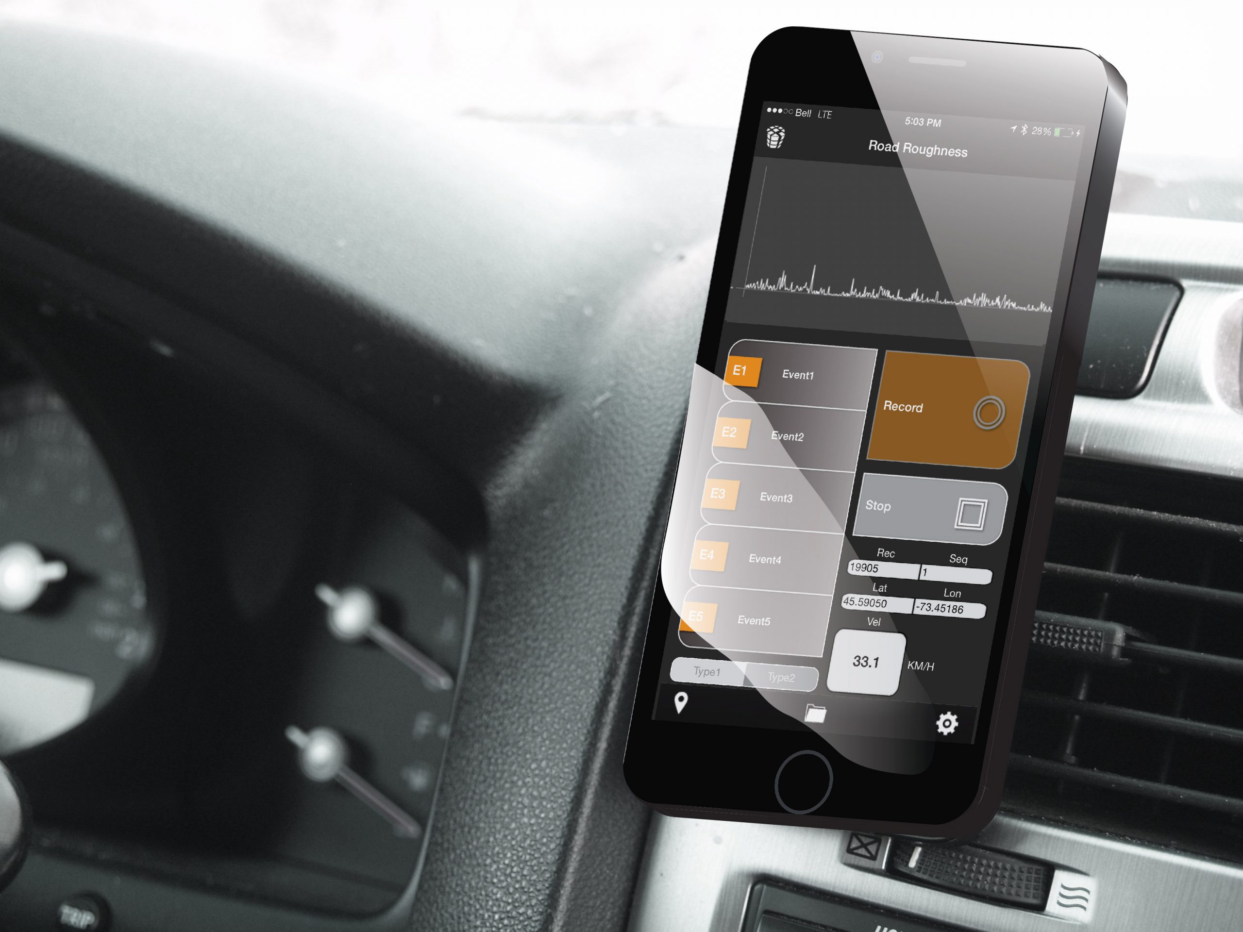
rRuf is a is a customized app for an iPhone or Samsung device that uses accelerometers and gyros to produce a Class 3, response based roughness index. This data is automatically tagged to the appropriate road segment by using the devices GPS and an intelligent map matching algorithm.rRuf is fully automated and can also collect windshield images at a user defined interval.
Fully Automated Roughness Indicator Collection
Integrated Mobile Image Capture for AI
- Class 3 IRI Data Collection
Automated GIS Referencing to Basemap
- Robust Calibration Module
Hot Spot / Distortion Detection
External GPS support
iOS and Android Compatible
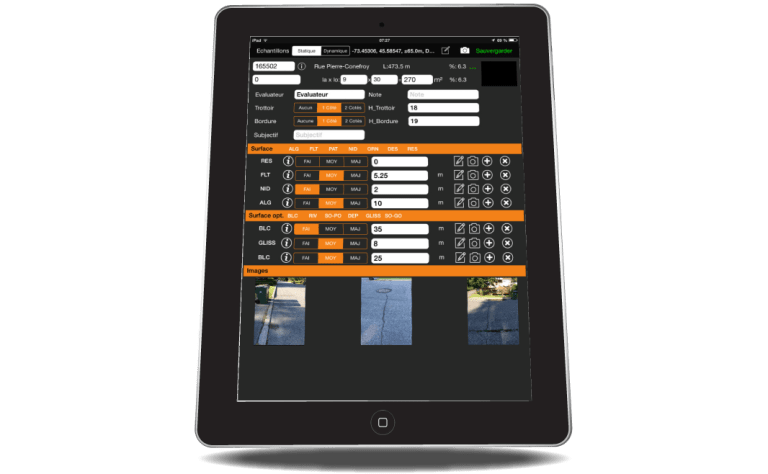
rInspector is an iPad / Andriod tablet condition rating application that allows users to collect and map infrastructure attribute conditions, locations, images, sketches and other information-based user-defined specifications and needsor pre-defined models available from Rival.The app is designed around making collection of infrastructure condition data as simple, efficient, and flexible as possible.
- Field and Web App versions available
Supports Mobile (Windshield) capture mode
- Highly Customizable Entry Forms
- Built In Industry Standard Inspection Methods
- Spatial and Linear Data Referencing
Automated GIS Referencing to Basemap
iOS and Android Compatible
Automated Processing Tools
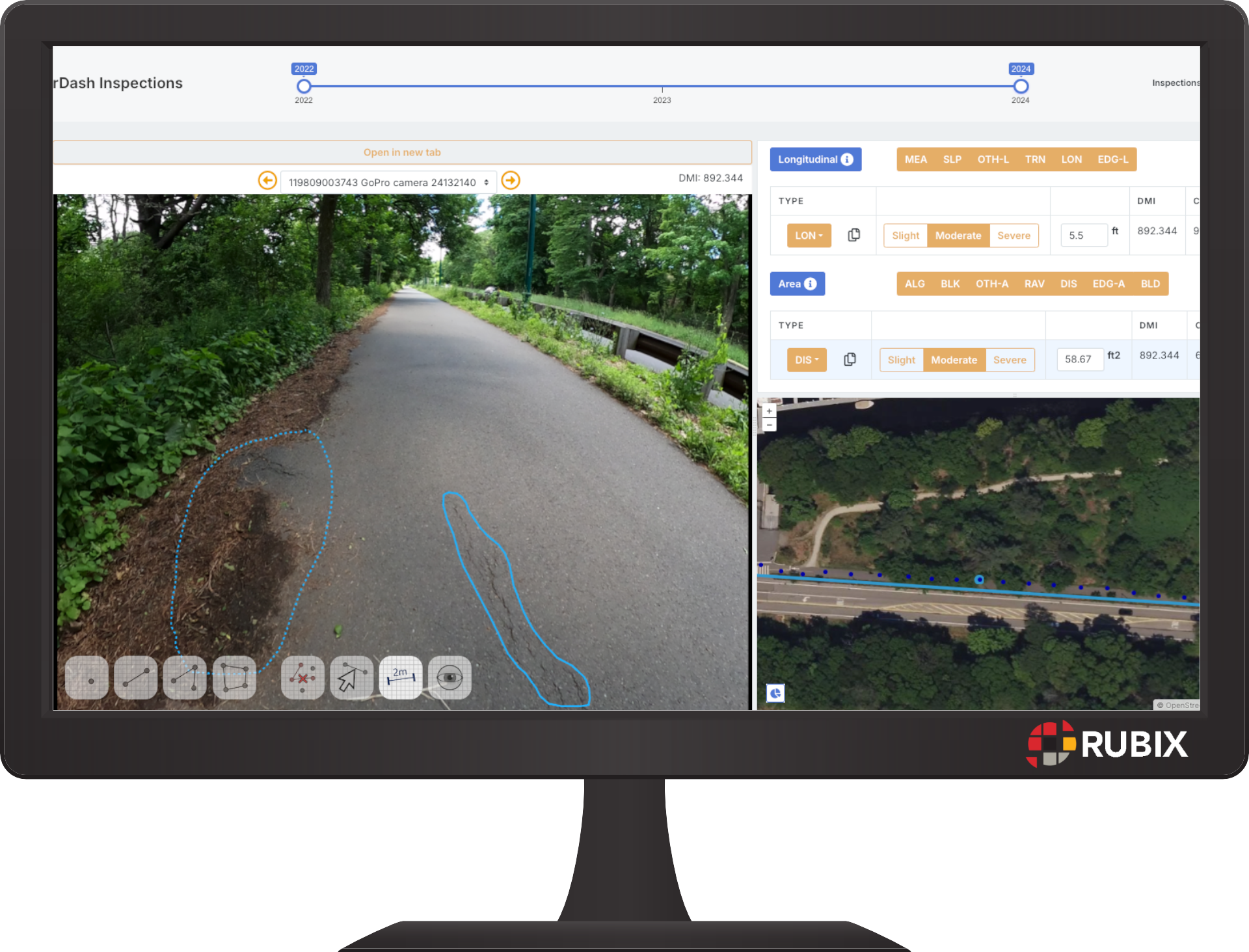
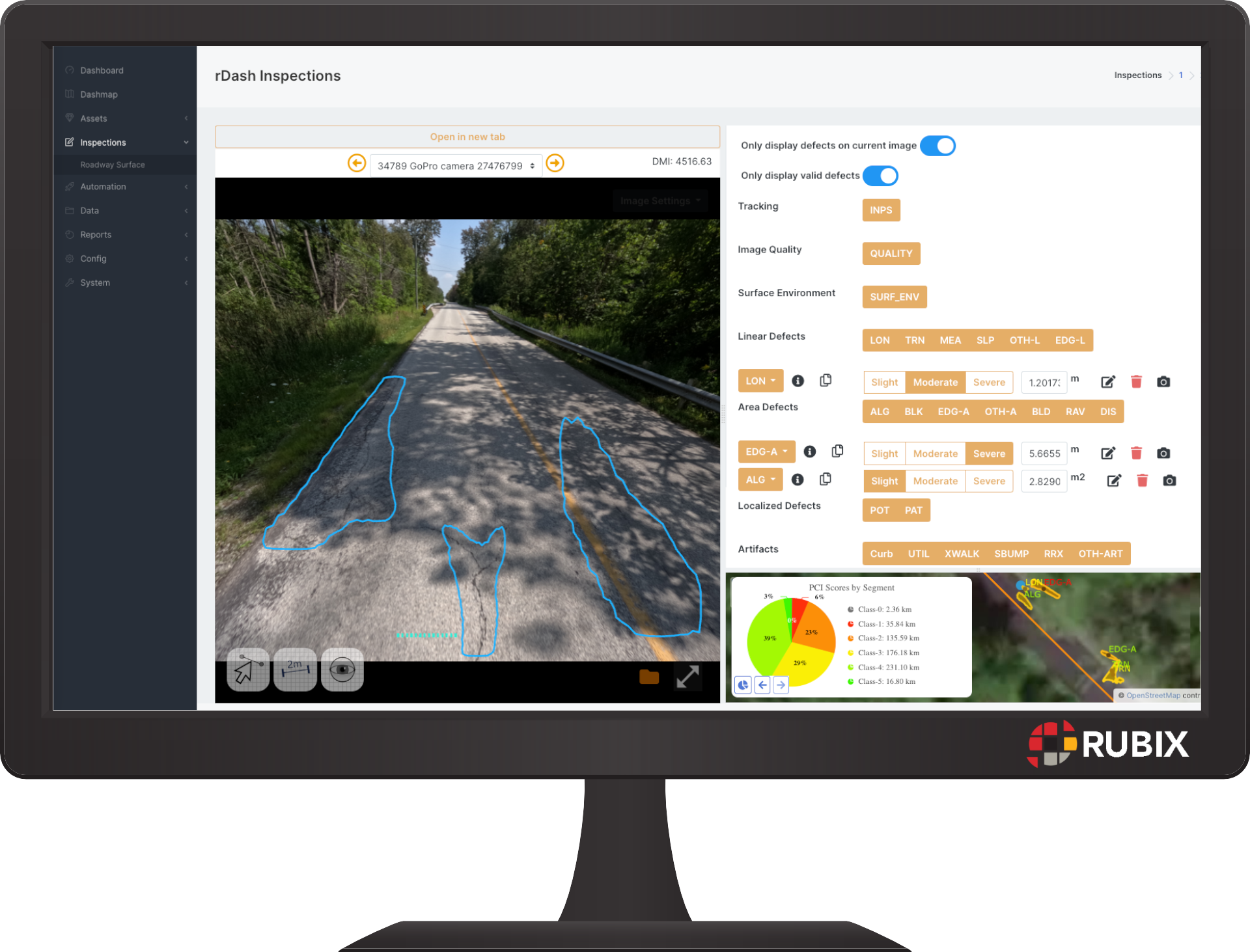
Road, Trail, Sidewalk, and Parking Lot inspections are automatically generated through an advanced analysis of mobile images gathered from smartphones or action cameras. The collected data is processed by a robust image analysis engine built on the RUBIX platform. This tool, rVision, uses Artificial Intelligence (AI) and produces a complete road inspection database based on trained industry standard AI processing models.
Automatically Detect Surface Defects
Detect Signs, Pavement Markings, and other Transportation Assets
Train Your Own Custom AI Models
Transform Detected Annotations to Spatial (GIS) Information
Automatically Blur Faces / Faces and Licence Plates
Deploy on Roads, Trails, Sidewalks, and Parking Lots
Review and QC detected information through GIS and Image Viewing web app
- Automatically compute accurate measurements using integrated photogrammetry principles
Data Review and Visualization
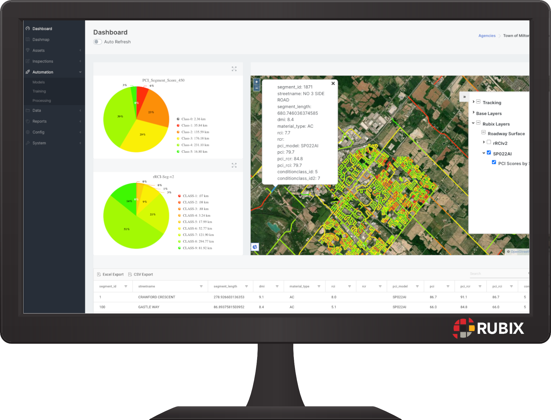
rDash is a web-based client dashboard that summarizes and presents data collected from the field or generated through any analytics engines.It is designed and built around a mapping platformand is highly customizable to end users’ practices.rDash also serves as a retrieval portal for those who wish to download flat files for (XLS, SHP, KML, CSV) to leverage the data in other software and processes.
- Browser based visualization of collected infrastructure data
- Create, modify, manage your own Inspection Methods for deployment to rInspector
Copy and Modify Inspection Methodologies from predefined industry standards
Export Data to common formats (ESRI, ASCII, XLS, KML)
Project Management and Production Tools
Manage User Access
Prediction and Planning Decision Analysis
Pavement Management Module
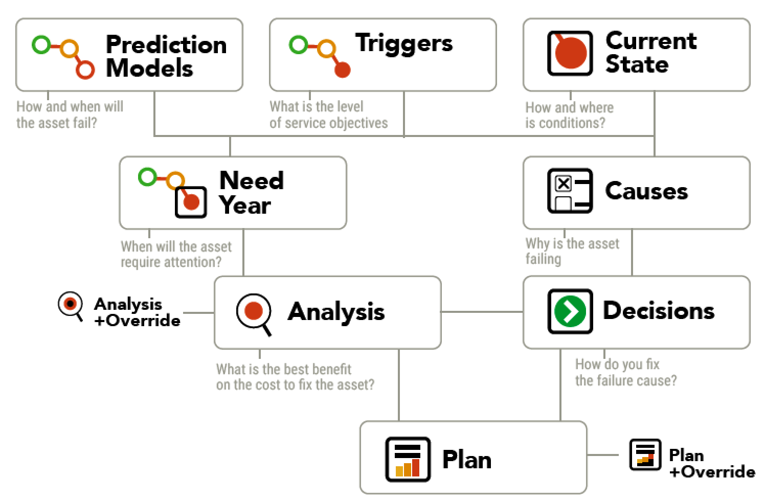
rMD is a data analytics extensionto the RUBIX process. This rule-based decision tool allows users to either leverage pre-defined engines already created by Rival (such as a pavement management tool) or implementtheir own business practices.Quite simply, rMD turns yourraw data gathered in the fieldinto actionable information and decisions.
Long Term Priority Planning Reporting
- Flexible Capital Plan Budget Analysis
Work Class Analysis (Maintenance, Rehabilitation, Reconstruction)
Integrated Asset Flexibility (Roads, Trails, Sidewalks, Parking Lots)
Work Tracking
Other Capabilities
Interoperability
All data reports and GIS layers are accessible through secure REST APIs. This allows IT and GIS professionals to directly access specific data from the hosted database without the need for exporting and importing data. It enhances efficiency and supports seamless integration with other systems and workflows.
Reporting
rReport allows for customized, dynamic reports based on data stored in RUBIX. Standard reports, stored in the rReport module, can be generated on demand, as a web-based report, or downloaded as a pdf for distribution or hard copy printing. The integrated report scheduler in RUBIX enables the automation and distribution of reports to specific users at defined time intervals. For example, weekly summaries on inspection progress or annual “State of the Infrastructure” executive summaries can be generated and delivered based on analysis and predictions.
Rule Based Validations
To ensure the highest quality of data throughout the data processing, validation rules are applied to each RUBIX workflow. These rules are applied to each processed data set and offer immediate flags for users consider during the QC process. While RUBIX offers a standard set of validation steps, rules can also be easily customized based on project specific needs. The validation rules serve as a framework for ensuring data integrity and accuracy.
Mobile Image Delivery
For users who require images to be delivered as an end product, RUBIX provides the ability to automatically manipulate images for final delivery. This includes the ability to filter images to a set spacing, stamp images with header information, blur faces and licence plates, and customize the filename and directory path of all exported images.